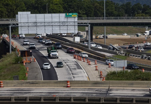
The Alabama Department of Transportation is launching an anti-litter campaign entitled “Trash Costs Cash.” The campaign will use television, radio stations, and social media sites such as Facebook and YouTube to highlight a major increase in litter fines and penalties authorized by the state legislature in 2019.
[Above photo by the Alabama Governor’s Office.]
The Alabama DOT – which spent almost $7 million in 2019 to clean up litter along state roadways – noted that fines for littering have doubled. The minimum fine is now $500, up from $250 for a first conviction, while the second conviction is $1,000 and up to 100 hours of community service.
“Litter can harm our environment and have a negative impact on road safety and the natural beauty of our state,” said Allison Green, coordinator for Drive Safe Alabama at the Alabama DOT, in a statement.
“If we each play our part in keeping our state clean, we won’t be impacted by the rising litter fines. More ALDOT funding can be spent on improving the roads we drive instead of litter pickup,” Green added.
Removing roadside litter is a costly ongoing endeavor for state departments of transportation, as illustrated by a study issued by the Pennsylvania Department of Transportation in February.
PennDOT’s study found that its crews, contractors, and volunteers removed 502 million pieces of litter from Pennsylvania’s roads in 2019, with the most common being cigarette butts (37 percent) and plastics (30 percent). The agency’s research also determined that plastic film and beverage containers were the most prevalent items – with an estimated 29.3 million beverage containers alone littering Pennsylvania’s roads.
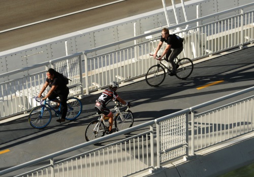
The California Department of Transportation plan to invest an extra $100 million into active transportation projects aims to build more non-motorized links between neighboring communities that, for years, have been connected mainly by freeway exit ramps.
[Above photo courtesy of the Metropolitan Transportation Commission.]
Some of the funds will be used for stand-alone active transportation projects, while some will go toward introducing walking and biking infrastructure into existing highway projects. Caltrans noted it already has identified 22 projects that now will have additional walking and biking improvements.
The plans “represents a critical step in our effort to build and enhance a transportation system for all users and make our communities more livable and vibrant places,” explained Toks Omishakin, director of Caltrans, in a statement.
Dave Snyder, executive director of the California Bike Coalition (CBC), added that the story behind this “active transportation” investment effort by Caltrans is just as significant as the $100 million the agency is offering to facilitate more walking and biking activity.
Caltrans “already had their set of projects for the next two years approved, and they were ready to go with their package,” Snyder noted. “Then this new director comes in and says, ‘I think we can do better for bicycling and walking.’”
Chris Clark, Caltrans media relations manager, said Snyder’s account is “100 percent accurate. In truth, Toks wanted more than $100 million.”
Photo courtesy of Caltrans
Omishakin, who was appointed director of Caltrans in September 2019 and is widely recognized as an active transportation advocate, told his staff to “value engineer” $4.2 billion of transportation projects in order to get an extra $100 million for bicycling and walking.
“That’s a very significant step,” CBC’s Snyder said.
The exact project identification process will take place at the local level, with each of California’s 12 districts holding public engagement sessions to help develop the District Active Transportation Plans and guide which projects will be constructed.
“They have made a strong statement, and I am impressed,” Snyder added. “What I can’t say yet is that they’re significantly changing the culture in the mid-levels of the agency, where important decisions get made. They have to be willing to prioritize the convenience of walking and biking over the convenience of highways.”
Caltrans’ Clark said he understands Snyder’s reticence, but he stressed that Omishakin has made it very clear “that active transportation is a top priority for the department.”
Other state departments of transportation are also increasing their support for more bicycle and pedestrian options in a number of ways.
The North Dakota Department of Transportation, for one, issued more than $2 million worth of Transportation Alternatives or TA grants to help fund a variety of urban and rural active transportation improvement projects across the state in July.
And in July 2019, the Ohio Department of Transportation noted that ongoing trends in safety, demographics, and demand spurred it to develop its first-ever policy plan for walking and biking – a plan the agency hopes to craft with public input gleaned from a series of stakeholder meetings and online surveys.
A report issued by the Rails-to-Trails Conservancy in October 2019 highlighted that there is an overall monetary benefit from investing in projects that shifting short trips from driving to walking and biking via connected active-transportation infrastructure. The organization argued that funding such a “shift” could help generate a return on investment of $73 billion to $138 billion per year in the United States – if such active transportation infrastructure is connected to public transit systems.
However, the organization emphasized in a statement that shifting short car trips in both urban and rural areas to non-motorized ones “will take policy, behavior, and perception change, which can only occur if connected networks of safe and protected walking and bicycling facilities are built all across the nation.”
One impact from COVID-19 pandemic being felt by state departments of transportation is the temporary cessation of “traditional” face-to-face public meetings to discuss upcoming transportation projects – with most of such gatherings going virtual.
In this podcast, Steve Olmsted – senior program manager at the Arizona Department of Transportation – discusses how his agency is handling the challenge of engaging the public and moving forward transportation projects during a time of social distancing.
“We call them virtual call-in public hearings,” he said on the podcast. “The meeting was presented by phone only and callers could verbally submit comments … with a court reporter transcribing the comments. The meeting was also simultaneously broadcast on free public radio stations – that is a novel thing for us and credit goes to our community relations team for that.”
To hear more about the “lessons learned” by the Arizona DOT from this process, click here.
The American Association of State Highway and Transportation Officials Center for Environmental Excellence (CEE) is looking for state assistance in updating the contents of its Programmatic Agreement Library or PAL database.
[Above photo courtesy of Oregon DOT.]
The PAL database functions as a “central library” or “one-stop-shop” for programmatic agreements between state departments of transportation and/or the Federal Highway Administration in partnership with resource agencies that help streamline compliance with federal environmental laws such as the National Environmental Policy Act, the Endangered Species Act, and the National Historic Preservation Act.
The PAL contains not only the programmatic agreement information; it contains a link to the full agreement and provides on-going access for practitioners to research agreements that meet specific requirements.
However, most of the agreements within the database are 10 years old, so the CEE is asking states to review the documents within the PAL to see if they are still valid, need to be updated, or removed entirely.
State agencies willing to help review those PAL documents can contact the CEE at environment@aashto.org.
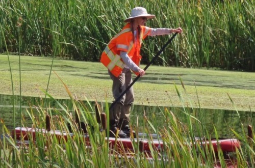
Volunteers with Klamath Wingwatchers recently helped the Oregon Department of Transportation resettle “sedges” from the Lost River Wetlands to the Lake Ewauna Trail in Klamath Falls.
“Sedges” are grass-like plants with triangular stems and inconspicuous flowers that typically grow in moist, wet ground. They are a major – often the dominant – plant of many wetland ecosystems throughout the world and their long, strong densely tangled stems and roots can help with erosion control. They also help improve water quality by acting as filters to remove pollutants and sediments; demonstrating the ability to remove a large percentage of nitrogen and significantly sequester metals such as copper.
Moving sedges to the Lake Ewauna Trail – Oregon DOT
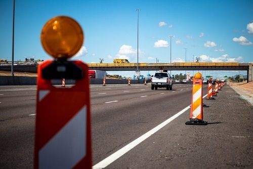
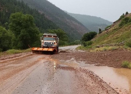
As state departments of transportation along the East Coast sharpen their disaster plans ahead of the peak point of the 2020 hurricane season – with mid-Atlantic and Northeastern state DOTs already grappling with flooding and high-wind damage cause by tropical storm Isaias – the Colorado Department of Transportation is deploying strategies to combat the summer monsoon season, which typically runs from mid-July until mid-September.
[Above photo courtesy of Colorado DOT.]
Monsoons – a term coined in the 19th century by the British in India to describe the big seasonal winds and heavy rainfall coming from the Bay of Bengal and Arabian Sea – can create flash flooding, mudslides, and rock falls that can severely damage affect Colorado roadways; causing major dilemmas for the traveling public and Colorado DOT maintenance crews.
For example, a seven-day-long flood event in September 2013 left behind a path of destruction over an area of 2,380 square miles, causing $700 million in roadway damage. Colorado also endured a major rock fall event in 2016 during monsoon season that closed I-70 in the Glenwood Canyon for approximately two weeks.
Those events encouraged state officials to take a deeper look into improving the resilience of Colorado infrastructure. As a result, the Colorado DOT and the Colorado Division Office of Federal Highway Administration worked to develop a plan to proactively identify and address vulnerabilities of the state’s roadway system to threats like flooding and landslides.
As a part of that plan, the two agencies kick-started the I-70 Risk and Resilience or R&R pilot project August 2016; examining 450 miles of I-70 from the Utah border in the west to the Kansas border to identify the potential for future damage and roadway closures due to extreme weather-related events such as monsoons.
The R&R pilot project – completed in the fall 2017 – provided risk and resilience information for assets along I-70 and helped the Colorado DOT prioritize work at key locations where risk is high and resiliency is currently low.
One of the areas identified as an important risk factor to road closures was culvert risk mitigation planning. Lizzie Kemp, Colorado DOT’s resiliency program manager, said that the study found flooding is the largest corridor risk when looking at user costs due to delays, with 80 percent of that risk due to minor culvert failure.
She noted that Colorado has nearly 60,000 culverts that fall into this “minor” category – under 4 feet long – and so the agency first prioritized repairing and/or replacing such culverts found in poor condition along critical routes. To help with that prioritization effort, the agency uses a Geographical Information System or GIS-based Culvert Risk Assessment tool (created by Gerry Shisler for the Colorado DOT) that takes data available statewide and uses it to identify culverts, their condition, and whether they are located on “critical” roadways.
The Colorado DOT found approximately 1,000 culverts across the state were in poor condition on critical routes and the agency than used that information to development and implement a three-step mitigation plan:
Step 1: Maintenance patrols complete an inspection of identified high-risk culverts and update the condition in the minor culvert database tool.
Step 2: Identify and document specific proposed mitigation actions for each culvert based on inspection, which could include replacing the culvert or making minor repairs.
Step 3: If replacement or repair is too costly or not possible, identify and document a specific operations plan which may include increased cleanout frequency and installation of technology to monitor hydraulic flows.
The Colorado DOT also found that minor culvert damage caused more than $94 million to roadway users from delays on the I-70 corridor alone; representing 80 percent of all user costs due to flooding. As a result, the agency expects that preventing minor culvert failure during monsoon flooding events should save hundreds of millions in highway user delay costs across the state.
The California Department of Transportation recently repaved a three-lane, 1,000-foot long section of Highway 162 using recycled asphalt pavement and liquid plastic made with single-use, plastic bottles – the first time the department said it has paved a road using 100 percent recycled materials.
[Above photo courtesy of Caltrans.]
The agency noted that such “plastic” roadways in previous test projects were found to be more durable and last two to three times longer than traditional hot-mixed asphalt pavement.
Using new technology developed by TechniSoil Industrial of Redding, CA, a recycling train of equipment grinds up the top three inches of pavement and then mixes the grindings with a liquid plastic polymer binder that comes from a high amount of recycled, single-use bottles. The new asphalt material is then placed on the top surface of the roadway, eliminating the need for trucks to bring in outside material for a paving operation. By eliminating the need to haul asphalt from the outside, this process can also help cut greenhouse gas emissions.
“This pilot project underscores the department’s commitment to embracing innovative and cost-effective technologies while advancing sustainability and environmental protection efforts,” noted Toks Omishakin, director of Caltrans, in a statement.
“Using waste plastic that was otherwise destined for a landfill will not only reduce the cost of road repair and construction, but also increase the strength and durability of our roads,” added California State Senator Ben Hueso, who has advocated that Caltrans test this material. “California is uniquely positioned to transform the transportation industry once again by using this new technology that could revolutionize the way we look at recycled plastic.”
Caltrans noted currently has a cold in-place asphalt recycling program that uses large machines to remove three to six inches of roadway surface and grind up the asphalt while mixing it with a foamed binding agent made of bitumen, a leftover sludge from oil refining. However, that recycled material used in this process is only durable enough to serve as the roadway base – and trucks must deliver hot-mix asphalt from a production plant located miles away and place a final layer over that base.
That’s why Amarjeet Benipal, director of Caltrans’ District 3, said the new plastic roadway process is better for the environment versus the cold in-place program. “It keeps plastic bottles out of landfills and helps reduce greenhouse gas emissions and reliance on fossil fuels,” he noted.
Several state DOTs are testing a variety of different products to help make roadway pavements more durable and environmentally-friendly.
The Minnesota Department of Transportation, for example, began testing a new asphalt additive along with two private companies in late 2018 along a stretch of Interstate 94 outside Albertville, MN, near the MnROAD research facilities – an additive designed to help highway agencies and contractors use more recycled asphalt and less “virgin” products. That additives – called a “rejuvenator” and made by agricultural conglomerate Cargill and aggregate supplier Hardrives – is a substance that promises to reverse the effects of aging when the existing asphalt roadway is recycled back into the new road.