After Bush Fire, Arizona DOT Pivots to Address Extreme Weather

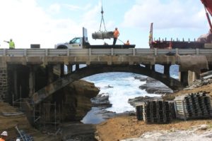
When combined with fire-ravaged terrain, heavy rain creates a whole new set of highway maintenance issues.

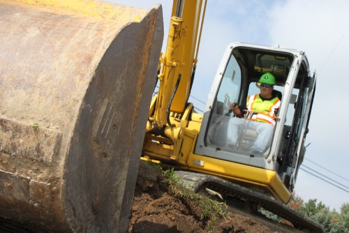
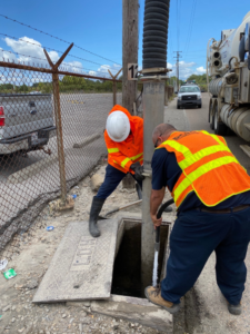
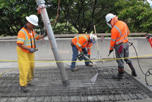
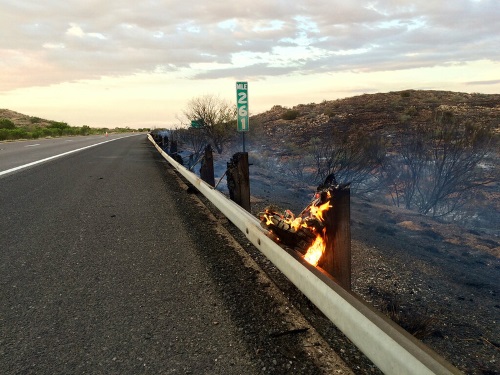
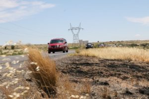
[Above photo courtesy of Arizona DOT.]

Take California, for starters. Already in the midst of fighting several major wildfires, the state is already gearing up for potentially damaging weather/terrain scenarios that can develop due to post-fire conditions.

The California Department of Transportation dealt with one such situation three years ago when a mudslide covered portions of U.S. 50 following several heavy and wet winter storms.

In Arizona, the infamous Bush Fire in June – a human-triggered inferno that burned more than 193,000 acres of desert and vegetation in Tonto National Forest near the northeast suburbs or Phoenix ― left behind dry, rocky terrain that could not handle the rushing waters of a monsoon, since the fire melted away vital ground cover.

Thus the need arose to craft a faster response effort to address those specific conditions. As a result, the Arizona Department of Transportation created an emergency action plan that dispatches specialized highway crews that can deal with the impact that heavy rain causes on fire-scorched terrain.

Photo courtesy of Arizona DOT

Part of the good news, explained Kevin Duby, statewide road weather manager for the agency, is that the Arizona DOT created this response plan at minimal cost plan by piggybacking off an initiative of the Federal Highway Administration’s Pathfinder Program. An offshoot of the Every Day Counts innovation recognition initiative, the Pathfinder Program, keeps travelers informed, and improves safety, mobility and the movement of goods during storms via enhanced collaboration between federal, state, and local agencies.

“We utilized previous plans obtained by research on the topic, which resulted in better use of time and cost savings for taxpayers,” said Duby.

With the help of the National Weather Service or NWS, the Arizona DOT identified “areas of the watershed where problems could arise and cleaned out the drainage ditches,” Duby emphasized, noting that no major construction was necessary because cleared culverts were already in place.

“They can accommodate the water in the normal flow from the steep slopes of the Mazatzal Mountains,” he said; a range known locally as the Four Peak Mountains.

Duby added that the Arizona DOT “already had a great relationship” with NWS via several groups from within the agency, from regional districts to operations to public relations.

The depth of those collaborations proved more advantageous and timelier than originally imagined.

“The plan was completed on July 28,” Duby said. “Then about a week later we had a mudslide on State Route 188,” which connects the towns of Globe and Payson, near Roosevelt Lake, which had been identified as a flood problem area.

“We worked with NWS to come up with protocols when a storm was imminent,” Duby noted. “One was for the NWS to call our traffic operations center,” to warn representatives of the impact of the rain.

At that juncture, the traffic operations center and public information offices broadcast the information on social media. Once the flooding occurred, the Arizona DOT executed its plan and was able to respond quickly with heavy equipment in a pre-staging area. That included vehicles such as loaders, skid-steers, and backhoes; as well as barriers and portable message boards. The agency also identified alternate highway routes – notably State Route 87 and U.S. 60.

Photo courtesy of Arizona DOT

“Part of the initiative is to be proactive about getting messages out to the travelling public, with the best information we can offer,” Duby pointed out.

While he said there is also an estimated cost savings aside from avoiding the commuter delays due to the Arizona DOT’s approach, it also helped alleviate the environmental issues that are part of any major weather event.

Without the efforts of the parties involved, “taking care of that sudden real world event would have been more complicated,” explained Duby. “We had to be sure that all three Arizona DOT districts are in sync, because they all have separates staffs,” adding that Phoenix and Flagstaff – about two hours away – both have NWS offices, so keen communication between the two proved critical.

Today, the focus is on taking what’s been learned from the Bush Fire and the mudslide and use that information to prepare for the next potential weather disaster. “We’ve refined our approach and that’s making traveling safer for our citizens,” Duby emphasized.

Broadband in the Right of Way: Ohio DOT’s Experience

Learning and working during the COVID-19 pandemic has made connectivity to the Internet more important than ever. That is why access to broadband service across the country is becoming essential for almost every communizing – providing critical virtual links to everything from online schooling to work-from-home opportunities. Those needs are not lost on the transportation industry.

[Photo courtesy of the Ohio DOT.]

That’s one reason why the Federal Highway Administration issued a notice of proposed rulemaking that would amend existing regulations governing the installation of broadband infrastructure on the right-of-way of Federal-aid or direct Federal highway projects.

According to the proposed rule, “highway rights-of-way are commonly used to accommodate public utilities, such as phone lines, electrical lines and pipelines. Expanding their use to include wireless broadband technology is a ‘critical next step’ in advancing connectivity in rural America.”

[Editor’s note: The FHWA is accepting comments on its proposed rule until September 14.]

Many state departments of transportation across the country are already participating in local efforts to improve and expand broadband access.

While states do not support a strict federal preemption on how states manage broadband deployment on their own properties, Carlos Braceras – executive director of the Utah Department of Transportation and the 2018-2019 president of the American Association of State Highway and Transportation Officials – noted in Congressional testimony that speeding up the federal permitting process would help facilitate “the merger of technology between motor vehicles and infrastructure.”

Photo courtesy of the Ohio DOT

To that end, InnovateOhio – in partnership with the Ohio Department of Transportation – issued a 16-page broadband access report in September 2019 to provide a strategic plan for providing more broadband access to citizens and businesses.  “Whether it’s connecting children to information at school or connecting smart vehicles to infrastructure, access to broadband is vital in the 21st Century,” said Jack Marchbanks, Ohio DOT’s director. “ODOT has always played a role in helping connect our state and this is just another opportunity to do that.”

That report highlighted that efforts to utilize right-of-way come with “special environmental” considerations. For example, the FHWA recommends the best practice of resource sharing in order to avoid repeated excavation. For instance, Dig Once initiatives have led to agreements between state DOTs and broadband contractors that allow use of right of way for fiber installation in exchange for broadband installation for highway message signs and autonomous and smart roadway transportation innovations. FHWA also encourages the use of trenchless technologies for broadband installation to minimize erosion and destruction of the area from construction.

When state DOTs need to issue permits for broadband installation on highway rights-of-way, categorical exclusions can typically be used when a request is for underground or above ground power, telephone, or pipelines, where no new structures, facilities, or major improvement to those facilities are required. Generally, buried communication lines fit this category. 

As part of Ohio DOT’s strategic plan for broadband, the agency launched an E-Permitting System for right-of-way access that aims to be more convenient for permit requesters; especially in terms of saving time when requesting to install broadband fiber optic cable. This centralized, digital system replaces a paper-only right-of-way permitting system that the Ohio DOT managed across all 12 of its district offices. 

[Details are available online at transportation.ohio.gov/permits.]

The agency also noted that partnerships in Ohio are fostering “environmental innovations” when increasing broadband installation in the right-of-way.

For instance, the City of Defiance proposed using sensors to monitor chemicals that can lead to harmful algal blooms in the local watershed. Yet those sensors needed a robust internet connection to allow researchers access to algal bloom data in real time. As a result, the city proposed installing concentric “fiber rings” connected to the monitoring stations via the existing infrastructure right-of-way – eventually expanding those fiber rings to provide high-speed internet services to residential and business customers.

That is an example of a right-of-way project that not only expanded broadband to underserved areas but also simultaneously helped solve real-world environmental problems, the Ohio DOT noted.

ETAP Podcast: Hawaii DOT’s Ed Sniffen

In this episode of the Environmental Technical Assistance Program or ETAP podcast, host Bernie Wagenblast interviews Ed Sniffen (seen above), deputy director for highways at the Hawaii Department of Transportation, regarding how his agency is focused on improving infrastructure resilience.

Sniffen also serves as the chair of the Committee on Transportation System Security and Resilience for the American Association of State Highway and Transportation Officials. The mission of the TSSR committee is to coordinate national response efforts, identifies best practices, and fills research gaps to promote resilient and secure transportation systems across the country. To listen to the podcast, click here.

State DOTs on the Front Lines of Storm Preparations

State department of transportation crews along the Gulf Coast prepared for the arrival of two potentially dangerous storms this week – highlighting the key ways state DOTs protect critical infrastructure and the residents it serves during severe weather events.

[Above photo courtesy of Louisiana DOTD.]

Crews in Texas, Louisiana, and Mississippi cleared storm drains and ditches, lowered light masts, paused highway construction projects and pre-positioned barricades, signs, and portable dams to prepare for the impact of hurricanes Marco and Laura – even as forecasts for the intensity and paths those storms changed almost hourly.

“Hurricanes are part of living here,” explained Sarah Dupre, a public information officer with the Texas Department of Transportation.

“We’re treating it just like one big storm,” added Rodney Mallet, communications director for the Louisiana Department of Transportation and Development.

Photo courtesy of Louisiana DOTD

Part of Louisiana’s preparations means removing tolls on the Louisiana Highway 1 Bridge to accommodate a mandatory evacuation of Grand Isle, the state’s only inhabited barrier island. The Louisiana DOTD also pre-positioned dozens of school buses and motor coaches in other vulnerable areas throughout south Louisiana to aid with potential evacuations.

By Sunday, Mississippi Department of Transportation crews had removed computerized traffic light controllers from major intersections south of Interstate 10 and set the traffic signals to all-flash mode, noted Katey Roh, a public information officer with the agency. That action protects the controllers from floodwaters, while the controllers “flash mode” helps move potential evacuation traffic better than allowing the signals to run on regular cycles.

Although Mississippi does not have a contraflow plan – a situation in which vehicles travelling on a main road in one direction must use lanes normally used by traffic travelling in the opposite direction – it works closely with Louisiana DOTD’s contraflow plan. That plan uses all northbound and southbound traffic lanes on Interstate 55 and Interstate 59 to evacuate the greater New Orleans area into central and north Mississippi. As of Tuesday morning, neither Louisiana nor Texas had implemented a contraflow plan.

“Contraflow is a last resort,” explained TxDOT’s Dupre. “Right now, our crews are preparing for evacuations, and we have dispatched courtesy patrols to help motorists.”

Those three state DOTs also stressed that personnel and equipment must be pre-staged in relatively safe locations to respond to the most vulnerable, low-lying areas in the wake of a storm’s passage. “The most important thing is to make sure our resources are in the right places,” Mississippi DOT’s Roh said. “We’ve been through a number of storms like this, and we know which areas tend to flood, so our first responders are ready to go.”

Caltrans Issues Final Two of 12 Climate Change Vulnerability Reports

The California Department of Transportation recently finalized and issued the last two of 12 district-based Climate Change Vulnerability Assessment Reports; studies designed to create a “comprehensive database” to help Caltrans evaluate, mitigate, and adapt to the effects of extreme weather events on the state transportation system.

[Above photo courtesy of Caltrans.]

“The completed assessments cover all 58 counties in the state and give California a comprehensive evaluation of climate change effects on the State Highway system,” explained Toks Omishakin, director of Caltrans, in a statement. “We are now integrating the findings into our planning process to better protect California’s citizens, economy and transportation investments.”

The final two reports cover Caltrans coastal district 1 and coastal district 5 and examine the potential impact of rising average temperatures, higher sea levels, storm surge, and precipitation on California’s transportation system – climate change trends that the agency said, in turn, increase incidences of flooding, drought, wildfires, coastal erosion and mudslides.

Caltrans said that understanding the impact of climate change helps the agency assess physical climate risk to the transportation system and work towards adapting infrastructure to be more “resilient” to those impacts. For example, the agency’s 12 climate reports project that by the year 2085:

  • Sea levels will rise 5.5 feet along the California coast—affecting 130 miles of State Highway by accelerating soil erosion and cliff retreat.
  • Increased severity and frequency of wildfires could threaten more than 7,000 miles of state highway.
  • High temperatures on the central coast and in the northwest part of the state could rise by 6 to 12 degrees, increasing drought and wildfire potential.

Caltrans began publishing those climate change reports in December 2018 partly in response to Executive Order B-30-15 issued by outgoing Gov. Edmund G. Brown Jr. (D), which mandated the integration of climate change analysis into transportation investment decisions.

New Jersey DOT’s Role in State Transportation Electrification Plan

New Jersey Governor Phil Murphy (D) has set forth an aggressive goal of achieving 100 percent clean energy by 2050 for the state – and the New Jersey Department of Transportation will play a key role in helping attain that goal.

The agency is part of a broad statewide transportation electrification effort in line with the Rejoining the Regional Greenhouse Gas Initiative or RGGI; a multi-state, market-based program that establishes a regional cap on carbon dioxide or CO2 emissions.

In mid-April, the governor announced that RGGI auction proceeds will provide $80 million each year to programs that reduce greenhouse gas emissions, with a new, more all-inclusive Energy Master Plan outlining several state investment strategies that aim to electrify New Jersey’s transportation sector. 

Along with the Master Plan, the RGGI Strategic Funding Plan details how to move toward the goal of a greener transportation system. New Jersey’s plan for its RGGI revenue is designed to support legislation signed in January that calls for the state to have 330,000 registered electric vehicles or EVs by 2025 and 2 million by 2040. It also plans for 400 fast charging stations at 200 locations along major highways and communities by 2025.

To that end, the New Jersey DOT and several other state agencies –  NJ TRANSIT, the New Jersey Board of Public Utilities, the Department of Environmental Protection, the Department of Community Affairs, the Department of Labor and Workforce Development, and the Economic Development Authority – will work together within their respective areas to achieve the RGGI’s strategic goals. 

The specific strategies laid out for the New Jersey DOT within the plan include:

  • Promoting the use of the Logo Sign Program and Tourist-Oriented Directional Signing or “LOGOS” program to display the locations of EV charging stations on blue state highway exit signs. The state will also work collaboratively with local governments on transportation planning and land use/housing planning that will enable multi-modal transportation and EV-ready infrastructure.
  • Working to prioritize multi-modal accommodations in projects located in low- and moderate-income and environmental justice communities to promote more pedestrian and bicycle traffic as those two modes are part of the RGGI’s emission reduction strategies.
  • Looking at re-evaluating “Level of Service” metrics that measure the quality of transportation services and traffic flow and develop plans to mitigate congestion and reduce idling time for vehicles. 
  • Working with local governments to promote implementation of “Complete Streets” policies in municipalities, possibly with additional grants and incentives. As part of these efforts, the New Jersey DOT and NJ TRANSIT will continue to lead a multi-agency “Smart Growth” program called the Transit Village Initiative, which helps municipalities redevelop or revitalize their downtowns into dense communities within a half-mile of transit centers.
  • Deploying Transportation Systems Management & Operations or TSMO strategies to relieve road congestion through signal optimization technology; an effort funded via the federal Congestion Mitigation and Air Quality program to make traffic patterns more efficient and further reduce idling.

Yet even as New Jersey begins moving towards electrifying its transportation sector, the unintended consequences of funding shortages must also be considered.

The draft fiscal year 2020 New Jersey Transportation Capital Program, which funds both the New Jersey DOT and NJ TRANSIT for a total of $3.679 billion, depends on motor fuels tax revenues for funding – already significantly reduced due to the impact of the COVID-19 pandemic. As New Jersey encourages use of electric-powered vehicles, the state is also considering a replacement for lost fuel tax revenue and is participating in the I-95 Coalition Mileage Based User Fee study to see how such fees would affect different communities and how they would be collected.

FEMA Issues COVID-19/Hurricane Response Guidance

The Federal Emergency Management Agency has issued a 59-page document that provides Federal, state, local, tribal, and territorial or SLTT officials – along with those of private sector and non-governmental organizations (NGO) – guidance on how to respond to both the COVID-19 pandemic and hurricanes simultaneously.

“As SLTT partners continue to prepare for hurricane season and other emergent incidents, emergency managers should review and adjust existing plans – including continuity of operations (COOP) plans – to account for the realities and risks of COVID-19 in their prioritization of life-saving and life-sustaining efforts,” FEMA said in the document.” All reviews and adjustments to plans should factor-in FEMA’s planned operational posture, social distancing measures, CDC [Centers for Disease Control] guidance, and SLTT public health guidance.”

To ensure that operational decisions are made at the lowest level possible, FEMA is organizing to prioritize resources and adjudicate accordingly, if needed:

  • At the incident level, Federal Coordinating Officers (FCO – in consultation with regional Administrators – will work to address incident requirements using available resources. FCOs will proactively manage and identify risks and communicate new requirements to Regional Response Coordination Center or RRCCs as they arise.
  • At the regional level, the RRCCs will coordinate with FEMA personnel deployed to SLTT emergency operation centers and adjudicate resource requests until operational control is ready to be transitioned to the FCO at the incident level, when designated, and will adjudicate resources within their area of operation and coordinate with other RRCCs and the National Response Coordination Center (NRCC) as required.
  • At the national level, the NRCC will coordinate with the regions on requirements and adjudicate resources to address national priorities.

Hawaii DOT Studies Potential Flooding Impact on Infrastructure

The Hawaii Department of Transportation is looking at a range of studies that examine how the potential for sea level rise (SLR) due to climate change could impact transportation infrastructure. 

The most recent study, published in March of 2020 examined how direct marine inundation – which is when sea water levels rising above the current land levels – could affect Hawaii’s infrastructure but also at the impact of groundwater inundation, known as GWI.

GWI describes flooding that occurs as groundwater is lifted above the elevation of the ground surface and buried infrastructure; a difficult flooding type to manage since groundwater flooding cannot be stopped by coastal barriers such as sea walls. 

That study – conducted by researchers at the University of Hawaii at Mānoa School of Ocean and Earth Science and Technology – predicts that sea level rise will likely cause large percentages of Hawaiian land area to be impacted GWI, with Shellie Habel, lead author of the study, noting that the results “highlight the need to readjust our thinking regarding the flooding that accompanies sea level rise.”

Ed Sniffen, Hawaii DOT’s deputy director for highways and chair of AASHTO’s Committee on Transportation System Security and Resilience, estimated in a previous report that it would cost around $15 billion to protect all of the state’s coastal highways from the rising seas. The figure assumed $7.5 million for every mile of road that will need to escape erosion in the next 50 to 100 years and $40 million for every mile of bridge.

The agency began a vulnerability study in December 2019 to develop a comprehensive inventory of “potential extreme weather impacts” to Hawaii’s highway system; impacts that include GWI, SLR, and other natural disasters such as rockfalls and landslides.

Photo courtesy of Hawaii DOT

That’s in addition to a statewide assessment of SLR impacts conducted in 2017, which resulted in the Hawaii Sea Level Rise Vulnerability and Adaptation Report. That report predicted a 3.2-foot rise in global sea levels by 2100, one that could be reached as early as year 2060 under more recently published scenarios. Chronic flooding with 3.2 feet of SLR could result in approximately 25,800 acres of land in the Hawaii unusable, with roughly 34 percent of that potentially lost land containing a large amount of highway infrastructure in Maui, Oahu, and Kauai alone.

Currently, over 38 miles of major roads could be chronically flooded across the Hawaiian Islands, ranging from residential roads to sections of coastal highways such as Kamehameha Highway on Oahu. 

And much of that flooding could be from GWI rather than just direct marine inundation, thus not stoppable by traditional sea walls, which is why the Hawaii DOT is looking closely at creative engineering mitigation strategies for all flooding mechanisms for highways and bridge foundations.

Part of the agency’s flood mitigation planning is based on a study conducted for the Hawaii DOT by the University of Hawaii – called State Coastal Highway Program Report – released in August 2019. That report uses a new, detailed formula developed by the university to rank nearshore roads in order of urgency. Most of its suggested mitigation efforts focus on either “hardening” the roads and bridges or relocating them all together to higher ground. 

As a result, for the next two decades or so, the Hawaii DOT plans to strengthen and maintain the roadways as they are in place. For the future, it is also looking at elevating roadways and even relocating highways further inland and tunneling through parts of mountains to make that happen.  For instance, elevating the highway on Oahu’s Windward side could involve raising the road as high as nine feet. An alternative solution would be to relocate the highway further inland which would likely include tunneling through parts of the Koolau mountains at greater cost, the agency noted.

Recordings Available for AASHTO COIVD-19 Virtual Panels

The American Association of State Highway and Transportation Officials recently made recordings available of its weekly series of COVID-19 “virtual panels” held in April.

The AASHTO Committee on Transportation System Security & Resilience, through its Resilient and Sustainable Transportation Systems or RSTS Technical Assistance Program, sponsored those panels, which focused COVID-19 response and recovery issues faced by state departments of transportation.

The panels featured COVID-19 updates from the Federal Highway Administration, Transportation Security Administration, and Department of Homeland Security as well as from other state and local transportation agencies, followed by a question and answer session.

The panel recordings and materials can be accessed by clicking here.

Can Highway Construction Achieve “Net Zero” Carbon Emissions?

What does it mean to be “net zero” in the transportation world today?  When talking about carbon emissions, it refers to achieving an overall balance between emissions produced and emissions taken out of the atmosphere.

For example, the building industry has been working toward “net zero” infrastructure for years.  According to the World Green Building Council, buildings are currently responsible for 39 percent of global energy-related carbon emissions: with 28 percent coming from operational emissions – from the energy needed to heat, cool, and power the structures – and the remaining 11 percent from materials and construction. 

Though highway roads and structures do not have the same level of operating emissions as a building, “embodied” carbon from the construction process significantly adds to transportation’s carbon footprint. Embodied carbon is the carbon footprint of a material. It considers how many greenhouse gases (GHGs) are released throughout the supply chain. This includes the extraction of materials from the ground, transport, refining, processing, assembly, in-use and finally its end of life recycling of disposal.  

The building industry now believes that embodied carbon in projects can be reduced 10 percent to 20 percent without increasing capital costs. One new study out of Sweden believes net-zero carbon emissions in construction supply chains can be reached by 2045.

Photo courtesy Hawaii DOT

But what exactly does this mean for highway and bridge construction? Many believe that policy is the starting point for significant reductions in carbon in highway projects. Globally, many countries are already requiring “net zero” infrastructure design. In Sweden, for instance, large transport infrastructure projects (roads, rail, tunnels) are required to calculate and report embodied carbon and monetary incentives awarded if embodied carbon is below a specified target. 

Some state departments of transportation are already working toward similar goals. For example, the Hawaii Department of Transportation started a testing project in 2019 using a concrete mix injected with waste carbon dioxide (CO2). The CO2 is mixed into the concrete using CarbonCure technology. The resulting product traps carbon dioxide in mineral form within the concrete and improves the comprehensive strength of the material. 

The test project involves a pour of 150 cubic yards of carbon-injected concrete next to an equivalent pour of standard concrete mix on an access road for the Kapolei Interchange. This test will allow the Hawaii DOT to do a side-by-side comparison of the carbon reducing mix versus a standard mix to determine specifications for the use of carbon-injected concrete for road projects in the future.

“We’ve seen the benefits to CO2 mineralized concrete and will be using it when appropriate in Hawaii’s road and bridge projects,” explained Ed Sniffen, Hawaii DOT’s deputy director for highways. “The availability of environmentally friendly materials such as carbon injected concrete is necessary for us to move forward in reducing the carbon footprint of our construction projects.” 

In an interview with Smart Cities Dive, Sniffen added that the carbon-injected material has turned out to be stronger and more workable, with no increase in cost over traditional concrete. “The overall carbon savings is significant,” he said. “We reduce it overall about 1,500 pounds into the environment. Now, that doesn’t sound like a lot, but really, that equals up to one car driving 1,600 miles continuously. So, it builds up quite a bit.”

How can such “embodied” carbon in highway construction be reduced? In general, highway designers can use Life Cycle Analysis based tools to determine the environmental footprint of a whole project and search for ways to reduce life cycle GHG emissions and other impacts through strategies such as:

  • Ensuring efficient use of materials (i.e. “right-sizing”)
  • Selecting materials with more efficient manufacturing processes
  • Minimizing transportation impacts through use of local materials
  • Using robust materials that require less maintenance, repair, and refurbishment
  • Choosing materials that can be reused or recycled instead of landfilled

Although there may be a learning curve and increased costs initially to incorporate embodied carbon reduction into construction decisions, it appears that the incremental costs of incorporating this analysis is comparatively small for the potential benefit it could provide. Complicated decisions and life cycle analysis must be done from the planning phase of the project through design and construction to significantly reduce embodied carbon and hit the “net zero” goal. In the future, these efforts will be driven by government policy and environmental stewardship of firms and contractors. It is inevitable that the wave of “net zero” goals in the building industry will continue to transition into the highway industry as well.